C1. what are settlement patterns?
Ans: A settlement pattern refers to the shape of the settlement as seen from the below picture. The shapes of early settlements were influenced by the surrounding landscape. They were also shaped by other factors such as who owned the land and whether the land was good for building on or not. Some examples of settlement patterns include, nucleated settlements, linear settlements and dispersed settlements.

2. Explain the significance of topographical maps?
Ans: Topographic maps are an important tool because they can represent the three-dimensional landscape in two dimensions. A person who can read a topo map can find out the location of peaks, valleys, ridges and saddles, among other land features. Topo maps can also show you whether you will be traveling uphill or downhill on a particular road or trail.
3. Explain the difference between permanent and temporary settlements.
Ans: Temporary settlement-
1. These settlements are built and occupied for a short period of time.
2. People practice hunting, gathering, shifting, cultivation.
3. Due to climate conditions or circumstances, people need to change there homes.
Permanent settlement-
1. These settlements have permanent houses.
2. People practice manufacture, trading, and other services.
3. People build a permanent house.
4. What is the different between a col and a saddle?
Ans: A saddle is literally that shape in the mountain that is high & broad at each end and narrower & lower in the middle. The saddle typically connects two mountains (or peaks). A Col is similar to a saddle but it always connects two peaks. Sometimes a Col is also understood as a saddle at high altitude.


A col is formed when lands has been cut considerably between two streams in a watershed. A col can be identified by a drop in height of the contours.
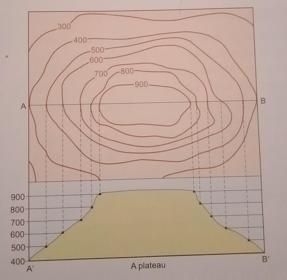
5. What do the contour lines of a plateau look like?
Ans: The contour lines representing a plateau are normally close spaced at the margins with the innermost contour showing wide gap between its two sides. A geomorphic feature lying between two hills or ridges and formed as a result of the lateral erosion by a river or a glacier is called a valley. It resembles the letter V.


Comments
Post a Comment